- Published on
Leveraging SAR data and InSAR technique to visualize ground deformation from Earthquake
INTRODUCTION
Earth Observation (EO) data plays a critical role in supporting disaster efforts. While optical imagery has dominated this field, Synthetic Aperture Radar (SAR) technology has emerged as an increasingly valuable tool. SAR generates a high-resolution image of the earth surface using radar signals making them useful in areas that are hard to reach or with extreme weather conditions. The capabilities of SAR to penetrate clouds, dust, smokes make them useful for monitoring disasters in challenging conditions, including tracking flood progression, conducting damage assessment, or detecting surface deformations that might result from earthquakes or landslides.
The European Commission has made access to Earth observation data possible through the Copernicus programme. Copernicus provides free and open data to users worldwide, including SAR data from the Sentinel 1 mission. This open-data approach is beneficial for resource-limited regions to support monitoring and developing systems that were previously out of reach.
WHAT IS SYNTHETIC APERTURE RADAR (SAR)
Synthetic Aperture Radar (SAR) is an advanced remote sensing technology that operates independently of sunlight, enabling continuous Earth monitoring day and night. Unlike passive sensors, SAR emits electromagnetic pulses and measures both the intensity of the returned signal and its travel time. This process generates high-resolution images based on how strongly different surfaces reflect the radar signals back to the sensor. These detailed images serve numerous purposes, particularly in monitoring natural disasters and environmental changes.
Interferometric SAR (InSAR) builds upon this technology by comparing multiple SAR images of the same location taken at different times. By analyzing the differences between these images, InSAR can detect and measure subtle changes in ground elevation and surface deformation with remarkable precision.
WHAT DOES EARTHQUAKE LOOK LIKE ON SAR IMAGE
We can examine SAR images from the Morocco earthquake using the InSAR technique to visualize and understand the ground deformation that occurred due to seismic activity.
Processing was done using ESA SNAP tool and all images generated by author
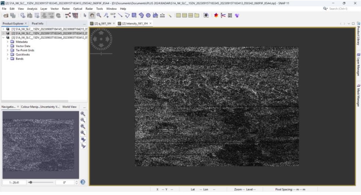
Raw SAR image (VV polarization) from September 15th, 2023, days following the Morocco earthquake
Sentinel-1 supports dual polarization: VV, VH, and HH, HV. The VV/HH polarization means that the radar transmits and receives signals in either vertical or horizontal polarization, while the VH/HV polarization means that the radar transmits a signal in one polarization and receives it in another. Each polarization has three subsets, and the data acquisition is carried out across three swaths: IW1, IW2, and IW3, with each swath containing three bands: i (In-phase), q (Quadrature), and intensity.
Co-Registration
Radiometric correction is carried to remove sensor specific effects before the co-registration
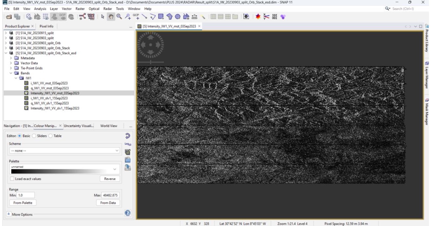
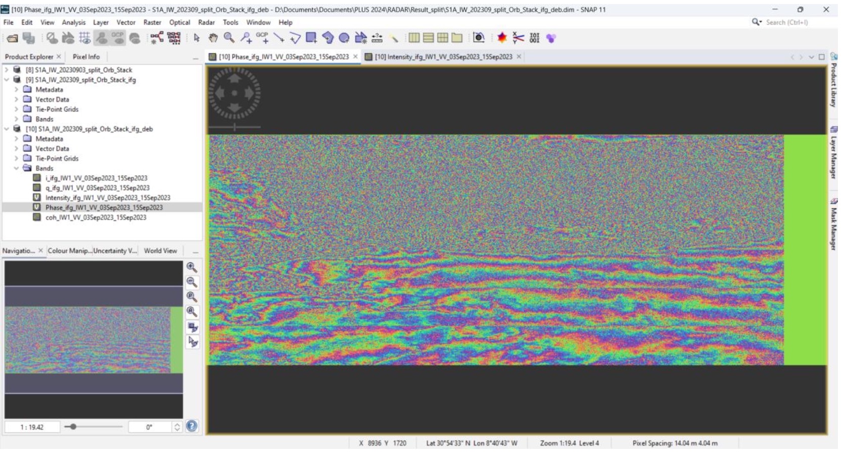
Coregistered SAR images from before (03-09) and after(15-09) the disaster
Co-registration refers to the process of aligning two or more SAR images so that corresponding pixels in the images match perfectly, spatially. This is a crucial step in InSAR because accurate alignment between multiple images is necessary to ensure that phase differences, which represent surface displacement are computed correctly.
Interferometric Phases: Topographic vs. Differential Interferogram
The interferometric phase between a pair of coregistered images contains various components, such as topography, surface deformation, and noise. After coregistering the images, the phase difference between them is used to create an interferogram, which includes both topographic and displacement information.
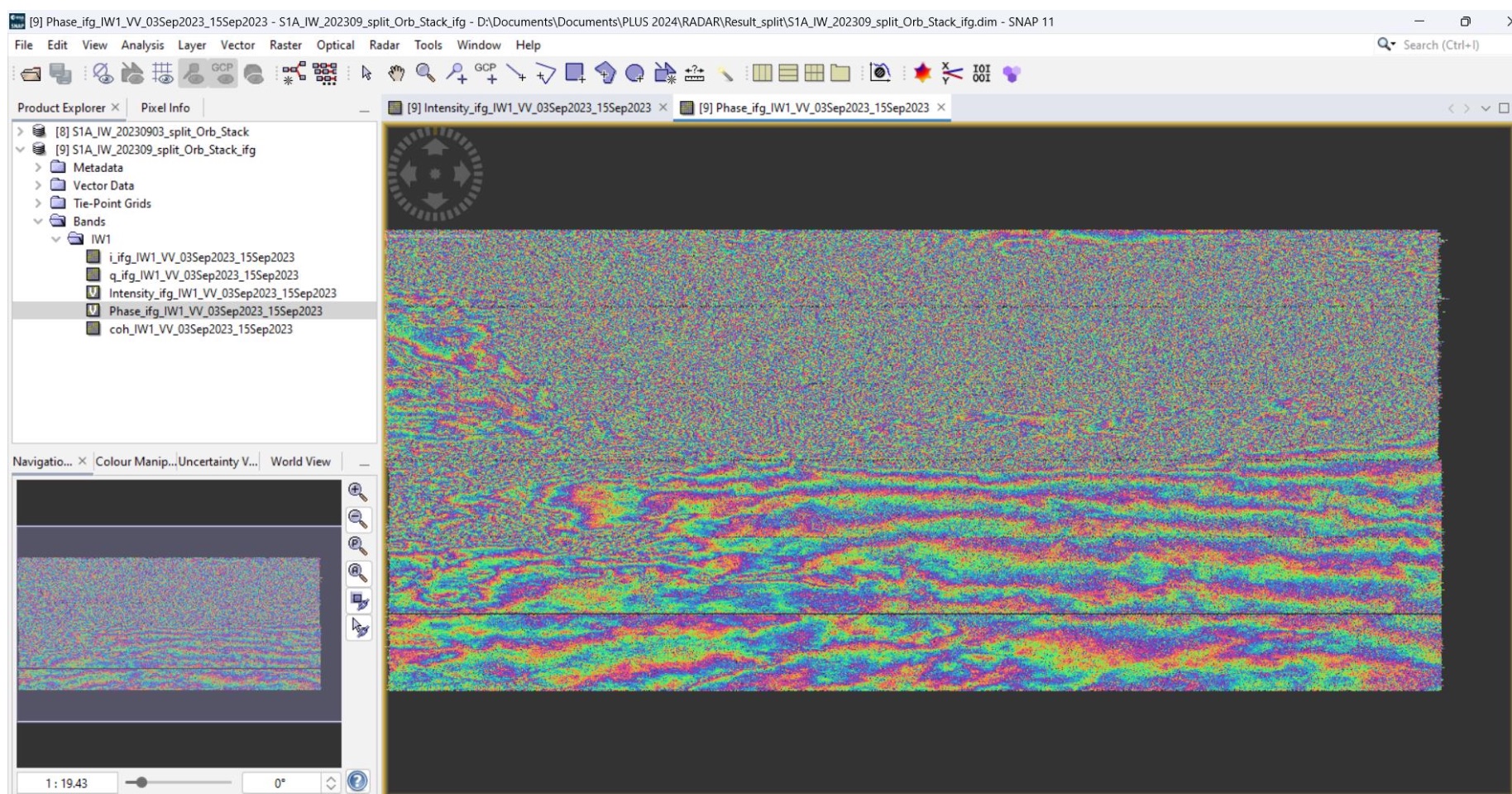
Interferogram
The topographic interferogram reflects changes caused by terrain elevation, as different elevations cause the radar signals to travel varying distances.
Topographic Interferogram
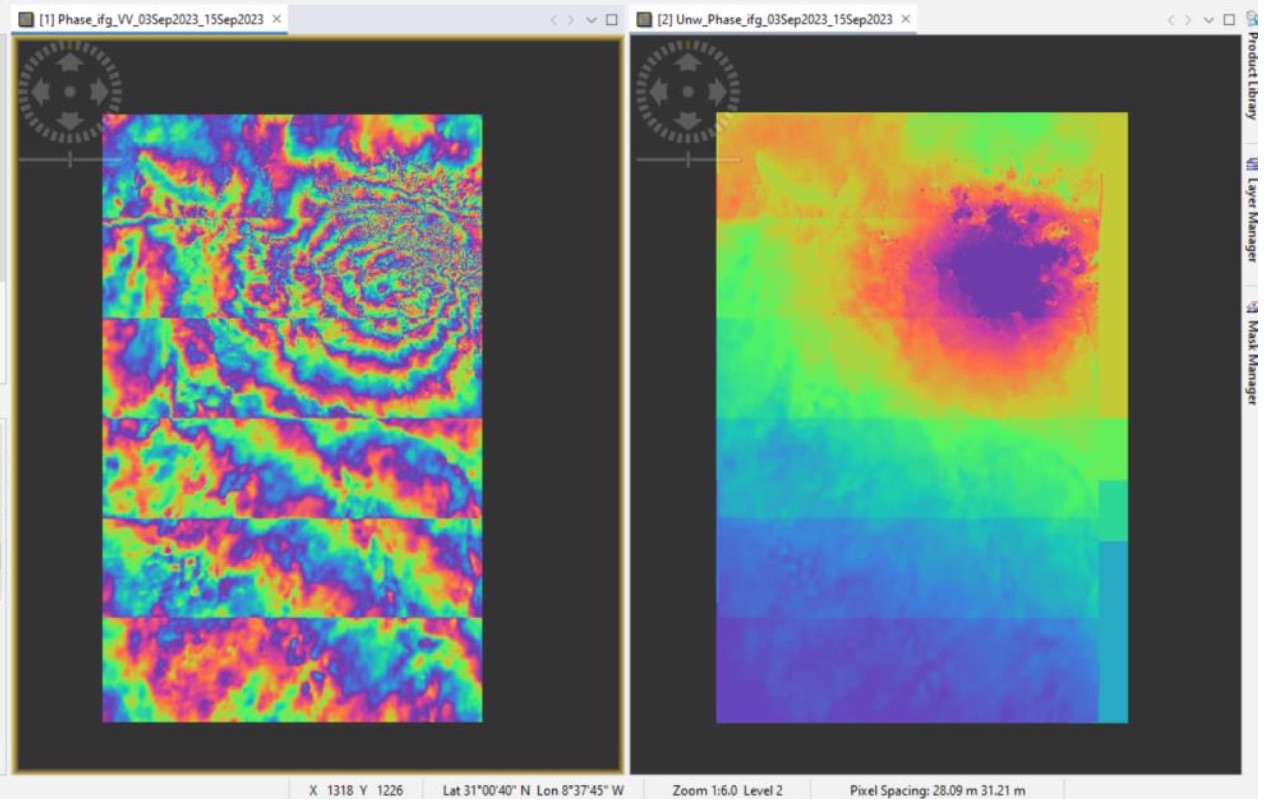
To focus on surface displacement, the topographic component is removed, leaving the differential interferogram that highlights changes in the Earth's surface.
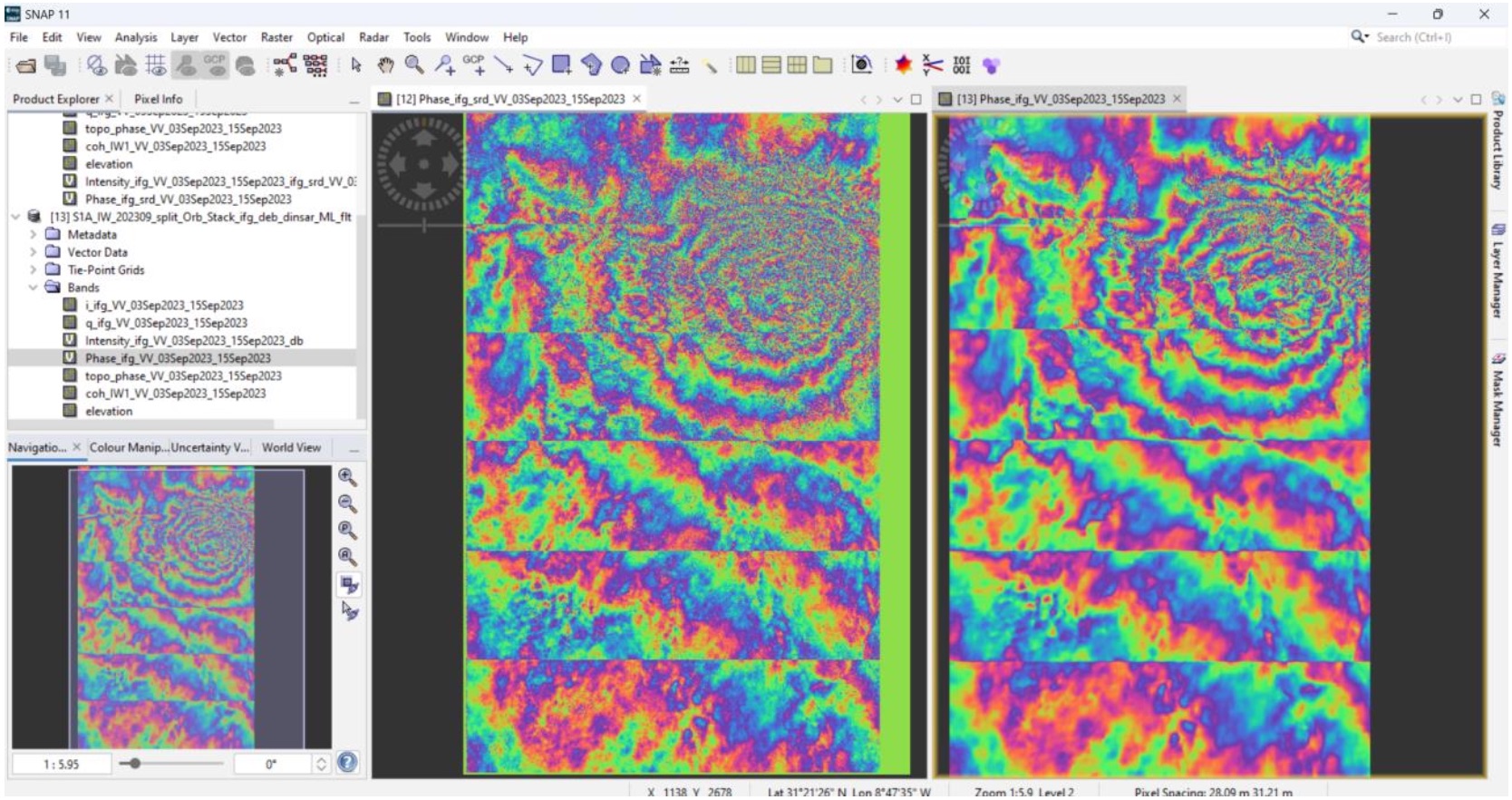
Differential Interferogram with additional proceesing (multi-looking and filtering)
Phase Unwrapping and Generating Displacement
To obtain a continuous displacement map, the phase must be "unwrapped." Phase unwrapping converts wrapped values from the interferometric phase into absolute displacement, providing a clearer and more accurate representation of ground motion.
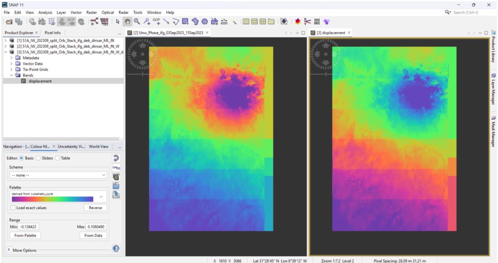
Left: Phase Unwrapping vs Right: Displacement
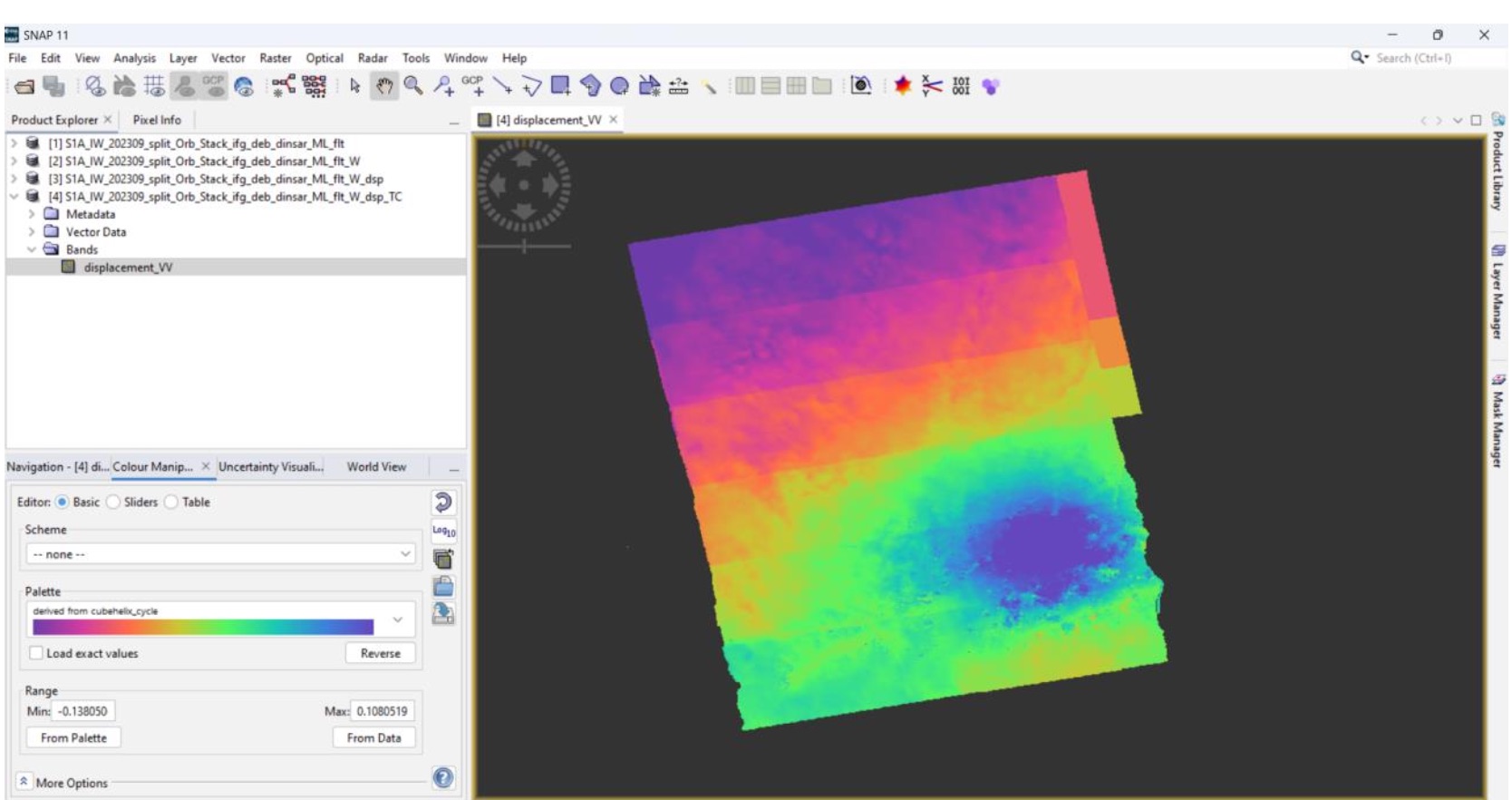
Georeferencing
To make the displacement map usable in other GIS applications, it often needs to be georeferenced. This involves converting from radar coordinates to geographic coordinates (latitude, longitude).
CONCLUSION
This has been an interesting introduction to SAR processing from a course work from my Master's program. As technology and data availability continue to improve, disaster efforts can become more efficient. The advancement in technology will continue to play a big role to ensure we can properly understand, predict and respond to disasters.
Happy to chat with anyone who has questions or is interested in geeking out about EO.
My Master’s program is in Earth Observation and AI (AI4EO) as part of the Copernicus Masters in Digital Earth.